


Satellite Footage Shows Devastating Path Of Hurricane Milton Over Florida
Meteorologists and emergency management officials are monitoring satellite data to track Milton's trajectory and intensity.
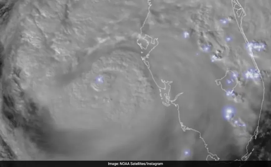
The National Oceanic and Atmospheric Administration (NOAA) has released dramatic satellite footage capturing Hurricane Milton's landfall in Florida, showcasing the sheer power of the storm from a cosmic perspective. The footage, released Thursday, illustrates the hurricane's spiralling mass over the southeasternmost US state, featuring intense lightning activity that illuminates its centre.
Milton struck Florida's west coast near Siesta Key on Wednesday as a Category 3 hurricane, forming a striking image of its eye encircled by dense cloud bands stretching hundreds of miles. The satellite visuals highlight the storm's massive impact on a wide area of Florida and neighbouring states.
"This imagery from NOAA's GOES-East provides visible cloud imagery every 30 seconds of Hurricane Milton as it pushes closer to Florida. Notice the frequent lightning being detected by the satellite's GLM instrument as well," the caption reads.
One of the most eye-catching aspects of the imagery is the frequent lightning flashes observed in southern Florida, where multiple tornadoes formed during the storm's passage. This captivating light show within the storm system underscores the extreme weather conditions experienced on the ground.
Milton moved across central Florida on Thursday, leaving a trail of destruction. With winds reaching up to 120 miles per hour at landfall, the hurricane caused extensive damage, uprooting trees, destroying homes, and leaving nearly 2 million people without power across the state.
Meteorologists and emergency management officials are monitoring satellite data to track Milton's trajectory and intensity. This information is vital for issuing timely alerts and coordinating emergency response efforts.
Although Milton has since weakened to a Category 1 hurricane, it continues to pose serious risks as it travels further inland.